新闻
LiDAR Drones with TOF Technology: Enhancing Precision and Efficiency
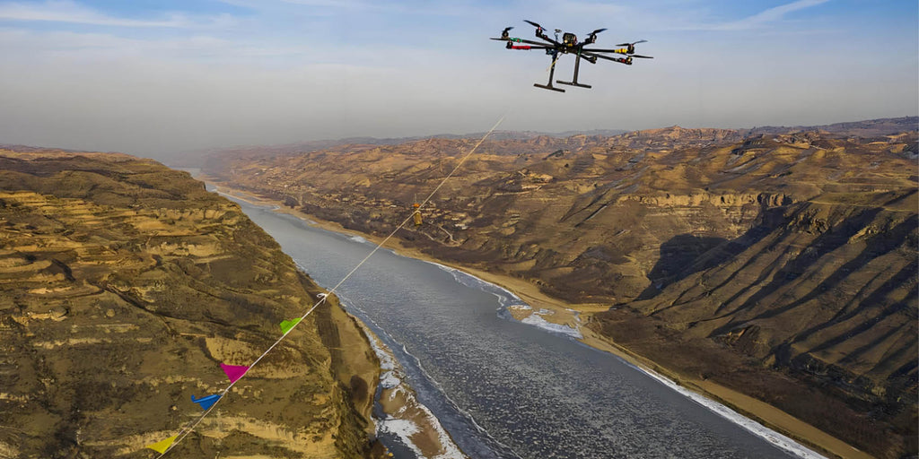
LiDAR Drones Enhanced with TOF Technology: A New Era of Precision and Efficiency In the modern era of smart cities, autonomous vehicles, and environmental monitoring, LiDAR drones have emerged as essential tools for high-precision mapping, surveying, and monitoring. When combined with Time of Flight (TOF) technology, these drones can perform even better, offering enhanced accuracy and rapid data acquisition in various challenging scenarios. TOF technology plays a pivotal role in...
People Counting and How ToF Technology Enhances Accuracy
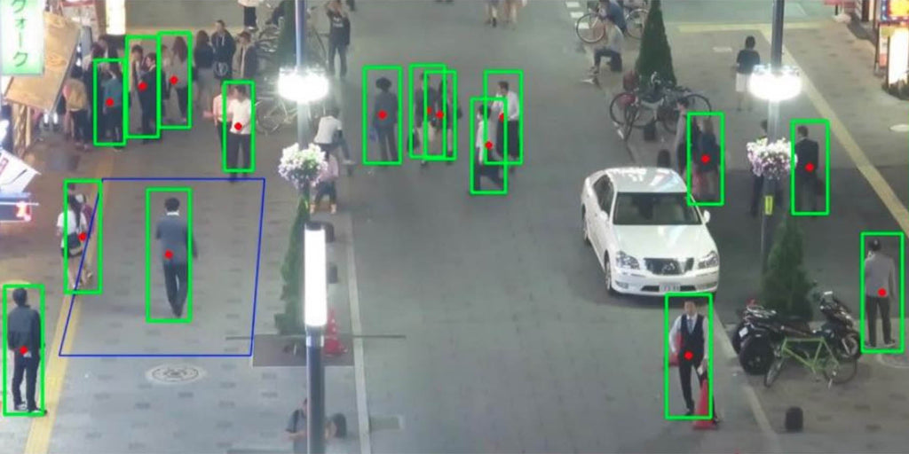
What is people counting called? People counting, also known as foot traffic analysis or crowd counting, is the process of tracking the number of individuals entering or exiting a designated space. It is used in various sectors such as retail, public transportation, event management, and urban planning. The information gathered helps organizations optimize their operations, improve safety, and enhance customer experience. People counting can be done manually or by utilizing...

What is a LiDAR Drone and How It Enhances Mapping & Spatial Awareness
What is a LiDAR drone? A LiDAR drone is an advanced unmanned aerial vehicle (UAV) equipped with LiDAR (Light Detection and Ranging) technology, capable of creating highly accurate 3D maps of terrain and objects. By emitting laser pulses and measuring the time it takes for the pulses to return after hitting an object, LiDAR drones provide precise 3D point cloud data that can be used for a wide range of...


Please upload banner from store admin blog pages